
The reservoir
Where this comes from. This page summarises two sets of engineering documents written in 2018, for other people: Associated Engineering's valuation of the plant and reservoir, prepared for Fish Creek Ranch, and MPE Engineering's North Distribution Assessment, prepared for the M.D. of Foothills. The co-op commissioned neither and has not had either re-checked. Every figure below is footnoted to the document it came from, and the MPE reports are published in full by West Foothills Water if you would rather read the originals. None of this is a commitment to a route, a cost, a water rate or a date.
The Fish Creek Ranch reservoir is an off stream raw water reservoir on Fish Creek, east of Highway 762 and about ten minutes south of the Hamlet of Bragg Creek. The reservoir makes year round treated water possible: it is filled from an intake on the creek when the creek is at high flow, and drawn down through the rest of the year to feed the treatment plant (Figure 1).
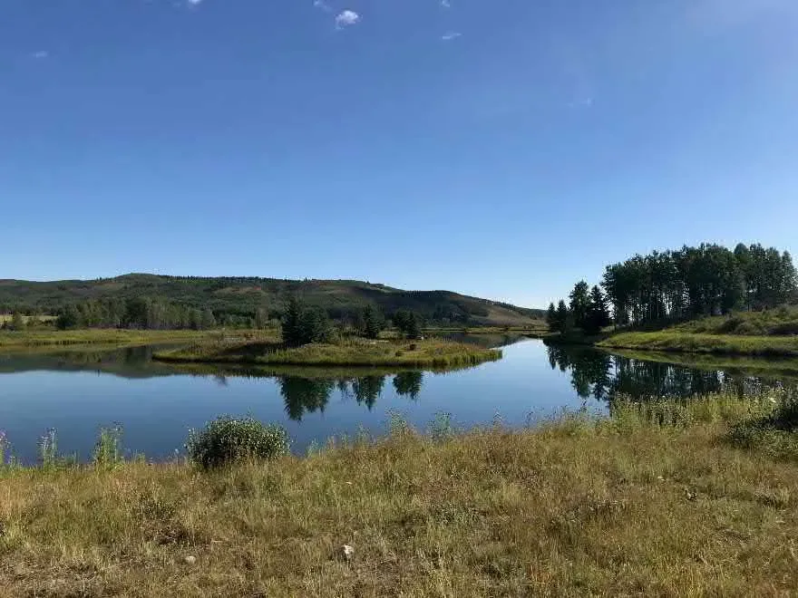
What is there
The reservoir was built in 2004, over eight months from April to November [1]. Fish Creek Ranch bought or leased the equipment and acted as its own general contractor [1]. It is an excavated basin rather than a dammed creek: roughly 56,700 m² of glacial till was taken out to a depth of 4 m, and blue clay was then removed to another 3 m and used to line the floor and the walls [1]. The excavated material was used to build the dyke along the highway and the berms [1]. Table 1 sets out what was built.
| Measure | Detail |
|---|---|
| Built | April to November 2004 [1] |
| Surface area | about 51,000 m² (5 hectares) [1] |
| Estimated storage | 263,000 m³ (about 210 acre feet) [1] |
| Liner | solid blue clay [1] |
| Intake | irrigation weir off Fish Creek [1] |
| Feeds | a well pump at the reservoir which pumps raw water 92 m to the treatment plant [1] |
The outflow is designed so that stored water circulates rather than stagnating or short circuiting [1]. Diversion from the creek is shut off during spring runoff and at times of low flow, when turbidity in Fish Creek is high [1]. That is what the storage is for: the water plant is fed from the reservoir, not from the creek. Figure 2 shows the basin in its setting, east of the highway.
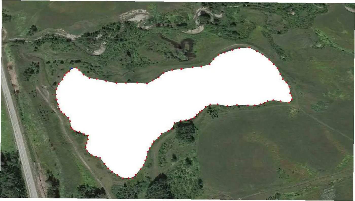
Storage is not supply
This is the point most often misunderstood. The basin holds about 263,000 m³ (210 acre feet), a little over two years of the licensed annual volume. A storage reservoir holds water that has already been diverted. It does not add to the amount that may be diverted. A 263,000 m³ basin refilled under licences totalling 112,000 m³ a year is still a 112,000 m³ a year system. Storage makes it possible to take water when the creek is high and use it when the creek is low or turbid. The annual volume the co op could ever supply is set by the water licences, not by the size of the pond.
The water licences, and why two different numbers appear
Two of the documents give different figures. Both are printed here.
The 2018 engineering assessment lists three licences held between Foothills County and Fish Creek Ranch, tied to specific service areas under the Water Act (Table 2) [2].
| Licence | Annual diversion | Maximum rate |
|---|---|---|
| 00321775-00-00 | 10,100 m³ | 1 L/s |
| 00321780-00-00 | 10,200 m³ | 1 L/s |
| 00220297-00-00 | 3,300 m³ | 1 L/s |
| 00483190-00-00 (2022) [3] | 88,800 m³ (72 acre feet) | 10 L/s |
| Total | 112,000 m³ (91 acre feet) | 13 L/s |
A fourth licence was added in 2022. Licence 00483190-00-00, issued to Foothills County on 28 July 2022, allows up to about 88,800 m³ a year (72 acre feet) to be diverted from Fish Creek at the Fish Creek Ranch diversion structure for municipal use within the proposed Fish Creek Ranch service area. It was created by transferring a 1962 licence and keeps that licence's 1962 priority. Diversion is allowed only when the flow at the Priddis gauge meets the water conservation objective set in the licence [3]. With it, the licences tied to the service area total about 112,000 m³ a year.
The valuation report, written four months later than the engineering assessment, instead lists a 266,000 m³ per year diversion from Fish Creek alongside the 10,100 m³ and 3,300 m³ licences [1]. Its own appendix explains where the large figure comes from: a letter from Alberta Environmental Protection dated 11 August 1998 approving Fish Creek Ranch to divert about 266,000 m³ of water a year (216 acre feet) from the creek [4], so the two large numbers are the same approval.
The most likely explanation, which has not been confirmed, is that the large figure is permission to divert water into storage, while the 23,700 m³ is what the current licences permit to be supplied to customers, each licence tied to its own service area. The co-op has not confirmed which is in force today, and the distinction decides how many households the system could ever serve. It is the first thing on the list of what still has to be established.
One piece of history matters here. The 23,700 m³ per year allocation was among the last diversion licences of its type granted before the 2006 moratorium on new allocations in the Bow River basin [1]. New licences of this kind are no longer issued. One has to be bought from an existing holder, which is how the county's 2022 licence came about.
What is not settled
- Which licence figures are current. The 2022 licence is on file. Whether the three licences listed in 2018 stand as listed, and how the 1998 approval of 266,000 m³ (216 acre feet) into storage relates to them, has not been confirmed with the county or with Alberta Environment and Protected Areas.
- The usable volume. The valuation report gives 263,000 m³ of storage [1]. The engineering assessment, four months earlier, worked on the assumption that "the existing raw water reservoir capacity (± 130,000 m³) is sufficient" and said that this too would have to be confirmed [2]. 130,000 m³ is about 105 acre feet. The co-op does not know whether the difference is total volume against usable volume, or an error in one of the two.
- Whether the creek can give up more. The engineers noted that further discussion with the province would be needed on whether the larger volumes could be diverted at the existing point of diversion at all, given established in stream objectives (ISO) [5].
Figure 3 shows the basin being dug in the summer of 2004.
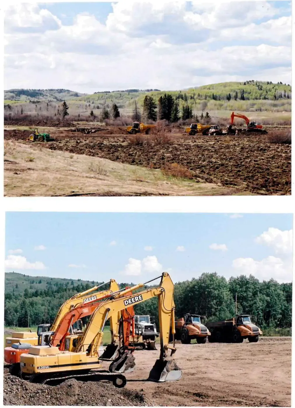
Related: The water treatment plant and Engineering work to date.
Sources
Associated Engineering Alberta Ltd., Fish Creek Ranch Water Treatment Plant Valuation, report prepared for Fish Creek Ranch (September 2018), secs. 1.1, 1.2, 3.2, and 3.5. Unpublished; a copy is held in the co-op's records.
MPE Engineering Ltd., "Fish Creek Ranch: North Distribution Assessment (Task 1)," letter report prepared for the M.D. of Foothills No. 31, job 2210-051-01 (May 24, 2018), table 1. West Foothills Water, accessed August 8, 2026, https://westfoothillswater.ca/.
Alberta Environment and Parks, Licence to Divert Water No. 00483190-00-00, issued to Foothills County under the Water Act (July 28, 2022), created by transfer from Licence No. 00357438-00-00, priority 1962-02-16-003. A copy is held in the co-op's records; licences are searchable at https://waterlicences.alberta.ca/.
Associated Engineering Alberta Ltd., "Strategic Value of Fish Creek Ranch Water Treatment Plant," app. F to Fish Creek Ranch Water Treatment Plant Valuation (September 2018), citing Alberta Environmental Protection, Natural Resources Service, to Fish Creek Ranch, August 11, 1998.
MPE Engineering Ltd., "Fish Creek Ranch: North Distribution Assessment (Task 2)," draft letter report prepared for the M.D. of Foothills No. 31, job 2210-051-01 (May 24, 2018). West Foothills Water, accessed August 8, 2026, https://westfoothillswater.ca/.
Questions about this document: info@fishcreekwater.co
Back to homepage